Sunday Walk on the Saw Whet Trail

walk august 14

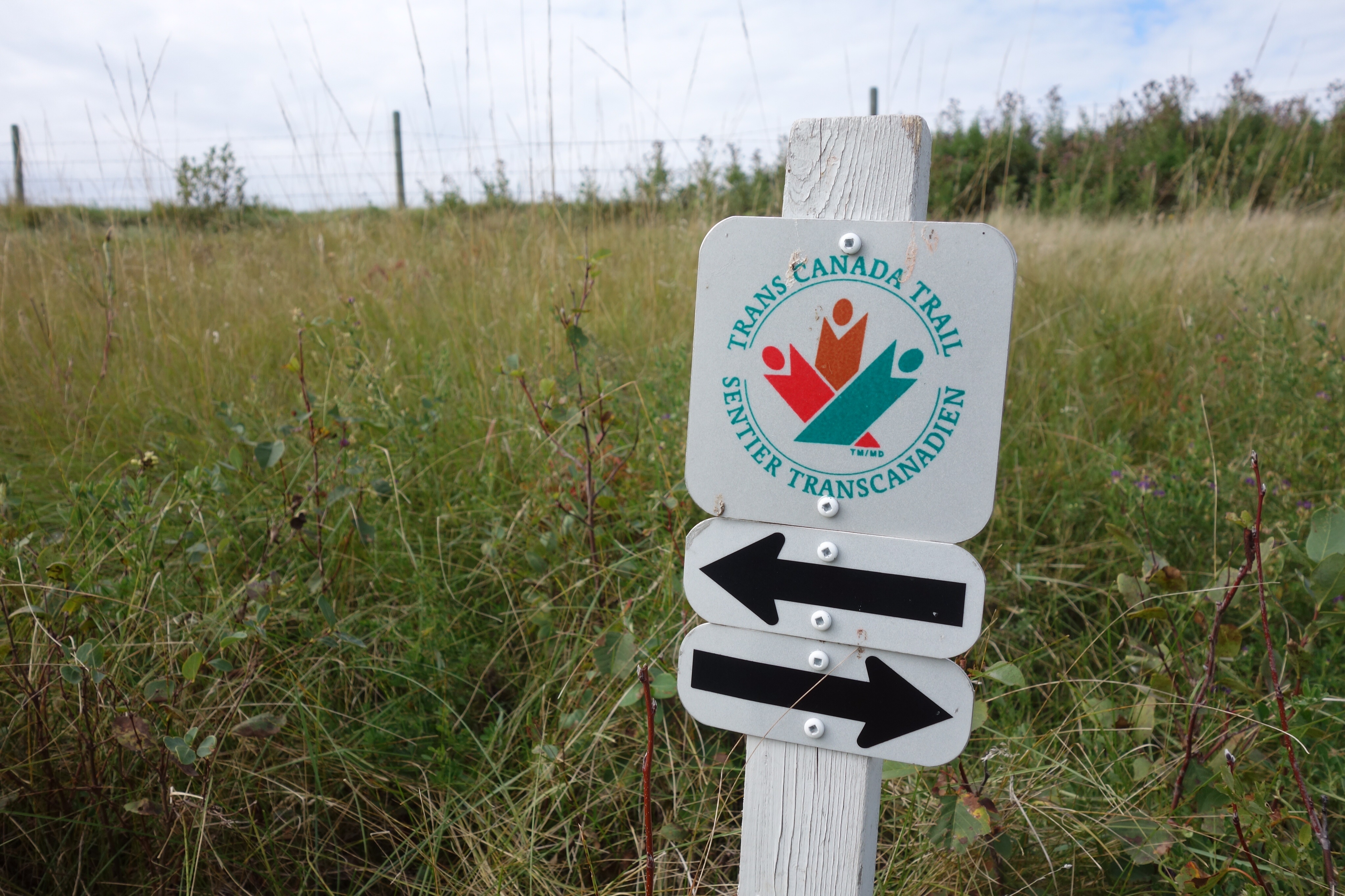
I was talking about the Saw Whet Trail at a birthday party the other night and realized that I haven’t gone out there for a walk in over a year. Time to do something about that, I thought, especially on a beautiful late-summer day like today. So I drove out this morning and went for a walk.

DSC04424

DSC04431.jpg

DSC04433.jpg


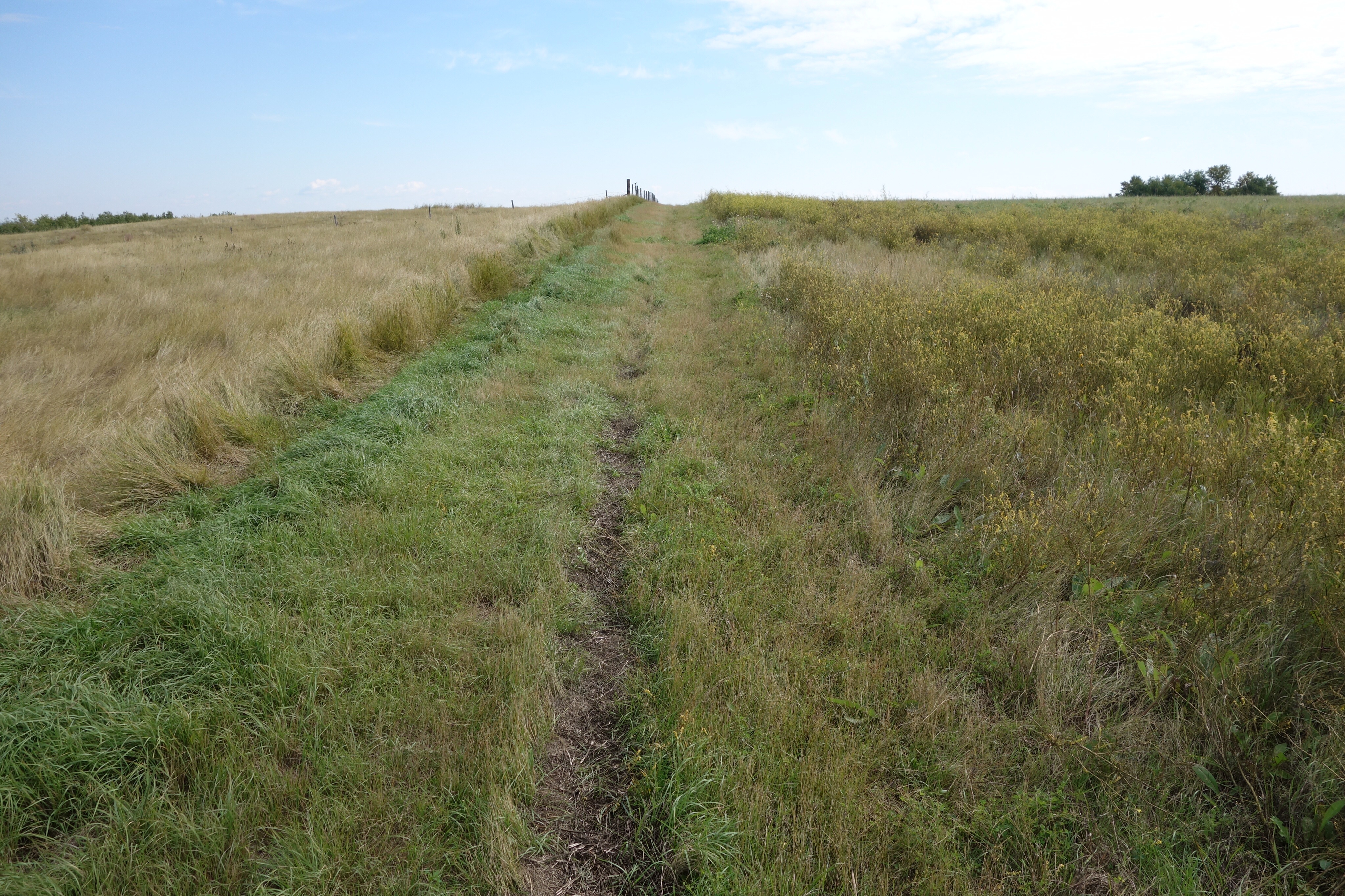
The Saw Whet Trail is part of a group of three trails (the others are the Lumsden Trail and the Deer Valley Trail) that run from Lumsden to Deer Valley. (You can find a description of these trails, and a map, here.) Added together, the three trails are 17 kilometres long. But the walk out of Lumsden is a dispiriting slog along a paved road (the trail is supposed to run through the ditch on the north side of the road, but in my experience that means hacking through waist-high thistles), and the trail through Deer Valley is usually overgrown because it’s rarely used. I prefer the 7 kilometre Saw Whet Trail.

DSC04434.jpg

DSC04444.jpg

DSC04447.jpg

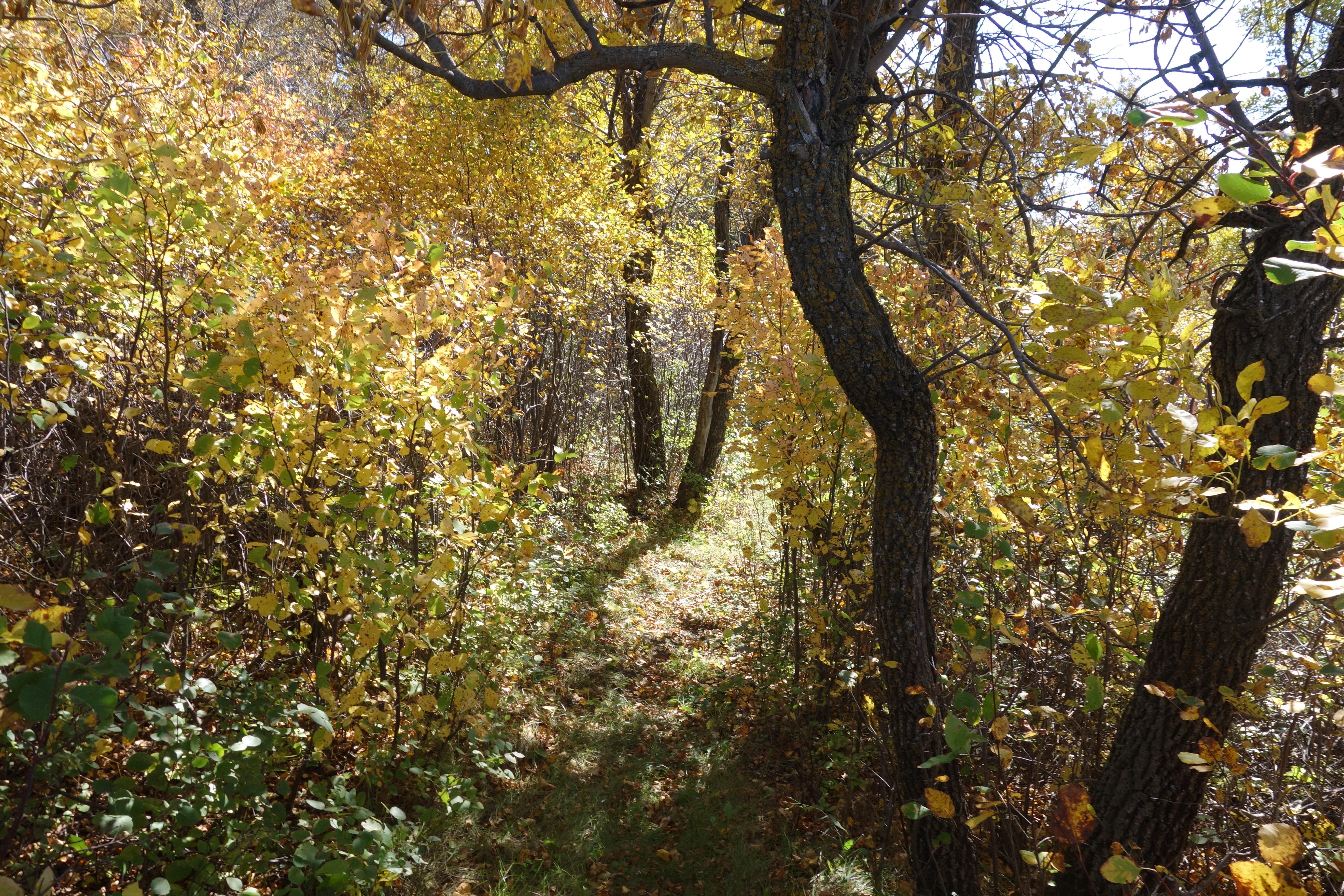
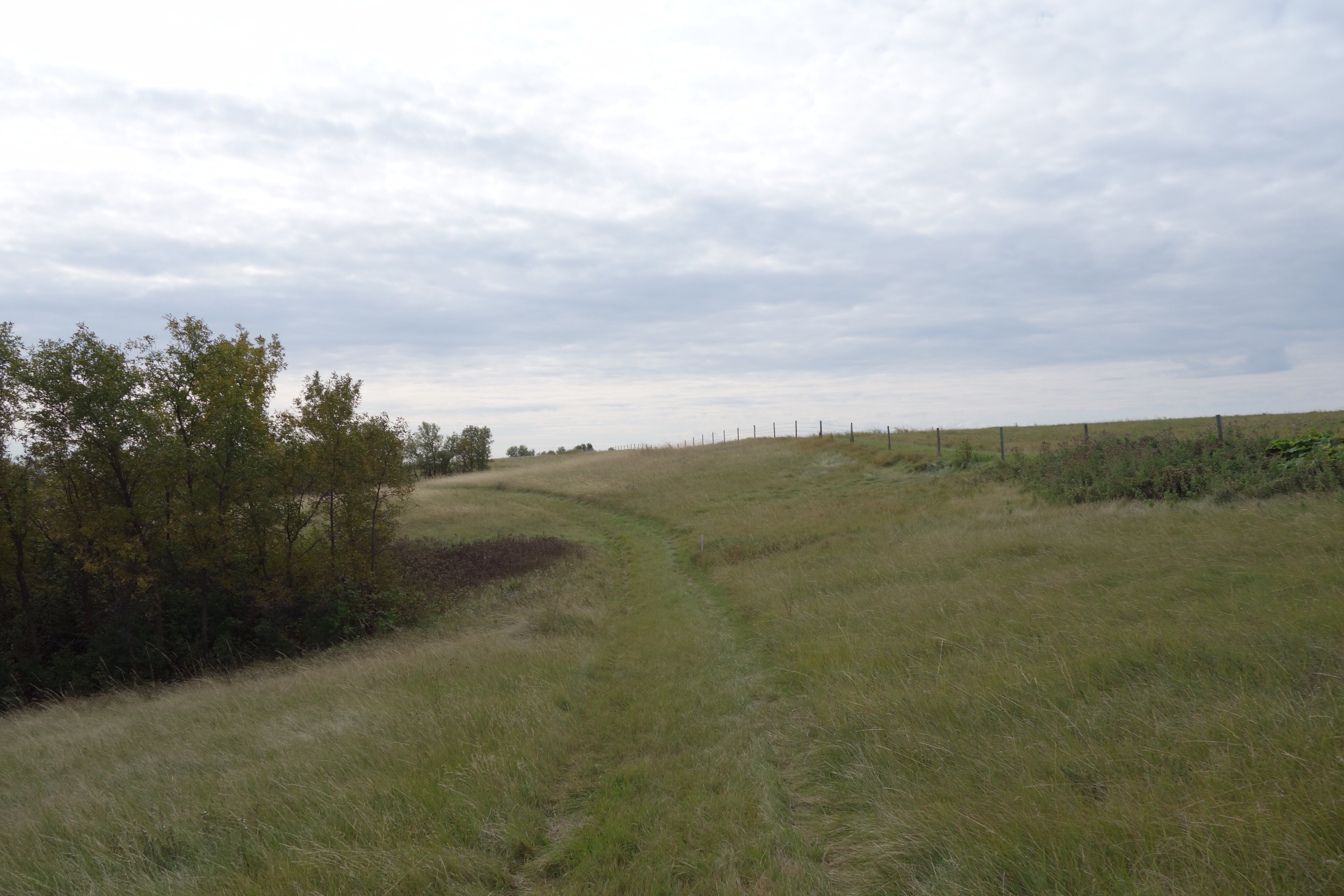
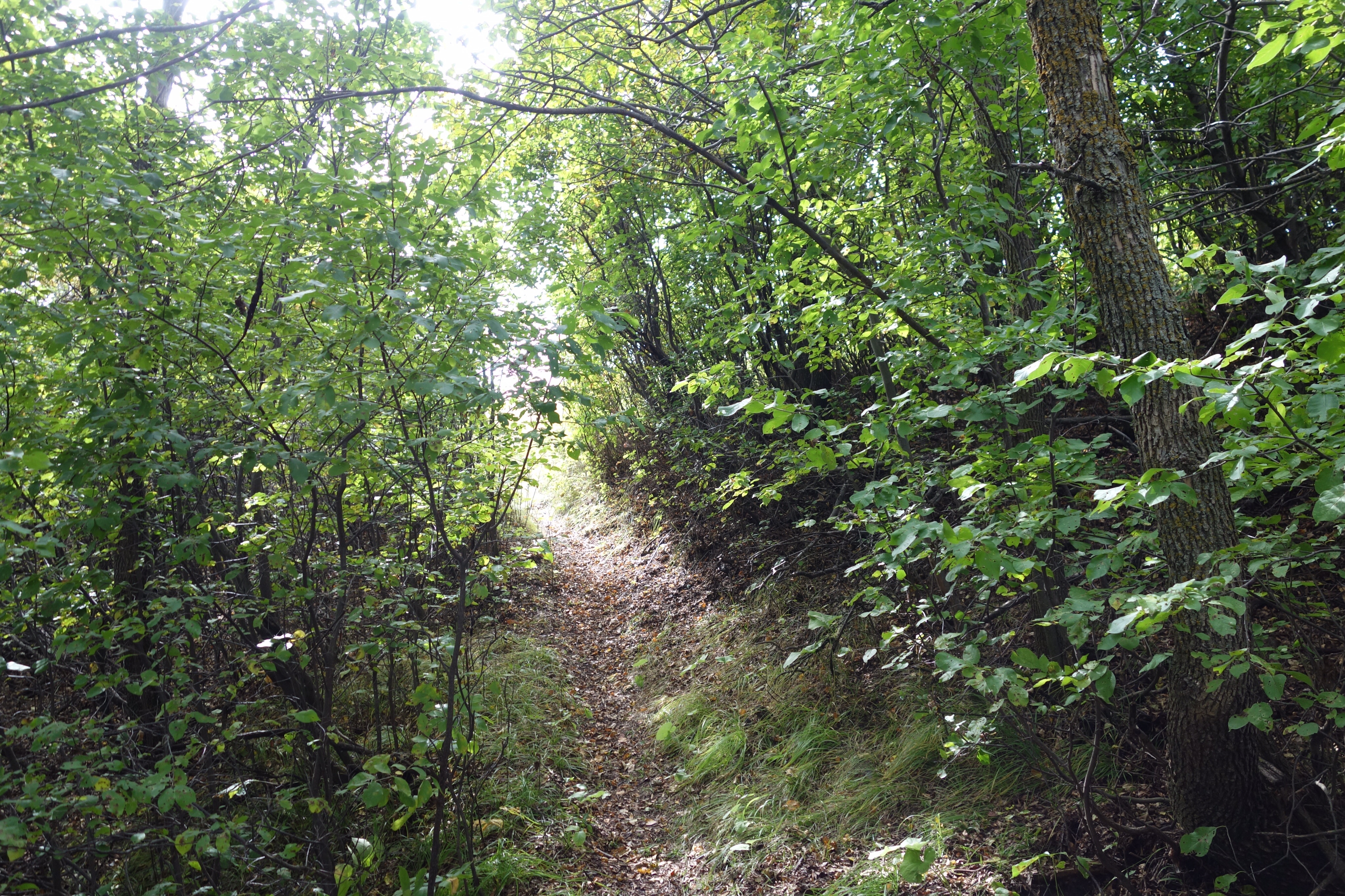
The trail runs across private property over the height of land between the Qu’Appelle Valley and the Wascana Creek Valley, alongside barley and hay fields and through patches of native prairie and wooded coulees. The portion that runs along Wascana Creek is less interesting, although it’s a great place for picking chokecherries. But it’s worth the walk down into the Wascana Creek Valley for the chance to climb up the hill on the way back to the parking lot.

DSC04452.jpg

DSC04455.jpg

DSC04460.jpg

I’ve been thinking about hills since I got back from Victoria. Living in a city that’s almost perfectly flat doesn’t give you an opportunity to prepare for going for a walk anywhere else, because almost no other place is as flat as Regina. To prepare for climbing hills, you have to find a hill to climb, and that’s not easy around here. Part of the attraction of the Saw Whet Trail is the fact that it has hills.

DSC04462.jpg

DSC04465.jpg

DSC04475.jpg

Of course, I was huffing and puffing on every climb, just like I was in Victoria, although the hills here are smaller and not as steep. I’m clearly going to have to spend the winter in the gym, trying to improve my fitness level. I can’t say I’m looking forward to it. But it has to be done.

DSC04478.jpg

DSC04485.jpg

DSC04487.jpg

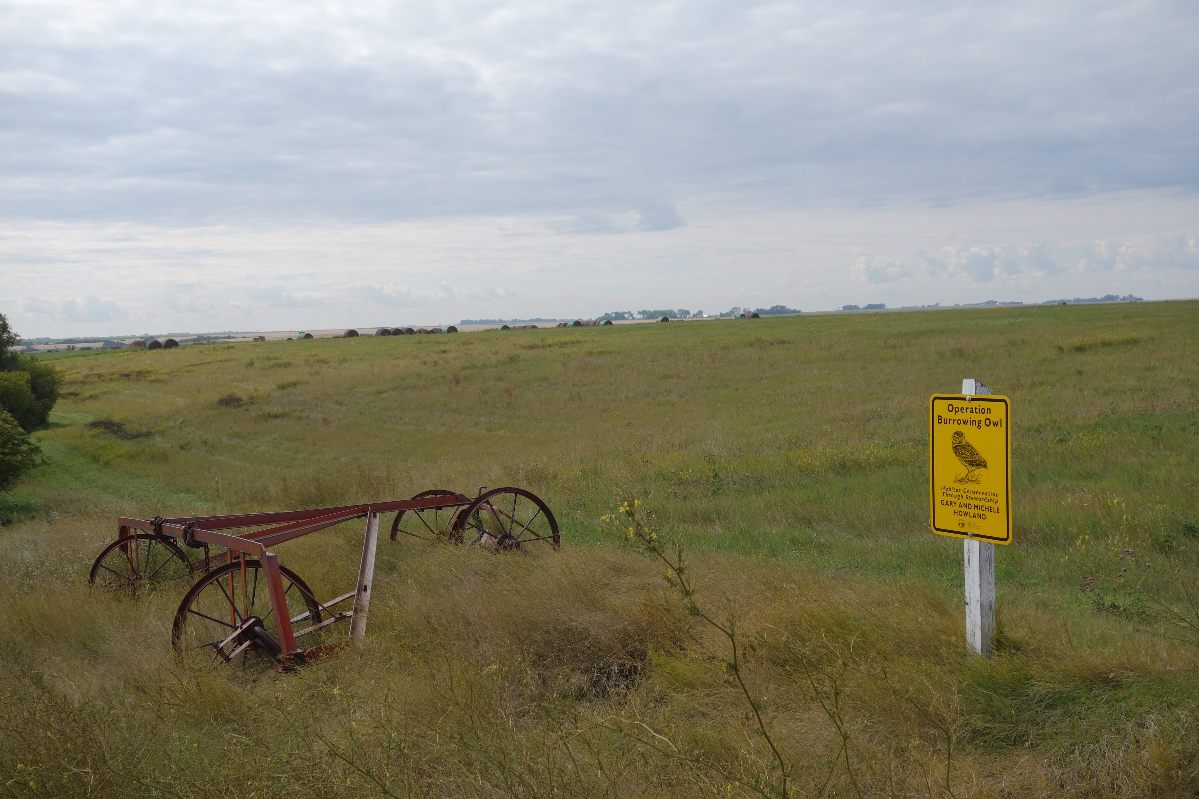
I saw many abandoned bales of hay, both on the hills and on the valley bottom. I suppose the price of hay was too low when they were baled to make selling them worthwhile. I can’t think of any other reason to cut and bale hay and then leave it to rot. The creek has been eroding the cutbank, and a stack of bales is falling into the creek. Another winter or two, and they’ll be in the water. Deer are eating them. A piece of farm equipment–I don’t know what it is–has fallen into the creek because of erosion, too. It’s almost completely submerged now.

DSC04510.jpg

DSC04490.jpg

DSC04477.jpg

One of the reasons I like this walk so much are the bits and pieces of remnant native grassland. I saw some of my favourite late-summer bloomers: coneflower, dotted blazingstar, asters, goldenrod, blue grama grass. Some hills are covered with purple stands of little bluestem. When I see these plants, I feel like I’m greeting old friends.

DSC04436.jpg

DSC04476.jpg

DSC04442.jpg

DSC04493.jpg

DSC04439.jpg

DSC04443.jpg

I got to the end of the Saw Whet Trail and ate a sandwich. Then I turned around and headed back. The return journey is always shorter, except on a long walk, when it can seem to take forever. Luckily, this was a short walk–only 14 kilometres in all.

DSC04494.jpg

DSC04509.jpg

DSC04514.jpg

DSC04519.jpg

It was a great way to spend the afternoon, and I plan to make this walk again before another year passes.

DSC04513.jpg

DSC04521.jpg

Fall Colours on the Saw Whet Trail

In the past week, the leaves have suddenly turned, and I thought it would be a good time to return to the Saw Whet Trail to see the fall colours before the leaves drop. Christine came along for the walk. We decided to only walk the Saw Whet Trail and leave the Deer Valley Trail for another day.

DSC01943

DSC01944

DSC02037

Another couple pulled into the parking area at the trailhead just before we arrived. They were carrying bicycles on the back of their SUV. “Is the trail okay for riding?” the woman asked me. I was noncommittal; if you’re a serious stump jumper, it would be okay, but I think it’s too difficult for casual cyclists, and I wasn’t sure what kind of riders they were. “Once you get out of the forest, it should be okay,” I replied. They set off, walking their bikes up the steep hill from the road. Later we came across their bicycles leaning against a fence. They had decided that the riding was too difficult, apparently. A while later we met them walking back along the trail. “It’s kind of hard to ride,” I said. “Yeah,” the man said, “we’re going to ride somewhere else.” That was the first time I’ve seen anyone else using the trail.

DSC01963

DSC01950

DSC02044

The colours were beautiful: the ash trees bright yellow, the chokecherries and Manitoba maples a rusty orange, the little bluestem on the south-facing hills a reddish purple. Despite the warm weather over the past week, the harvest has not advanced at all; the swathed canola is still swathed, the wheat and flax remains uncut.

DSC01955

DSC01957

DSC02057

There were lots of grasshoppers. One found its way up Christine’s pants; another was in my boot when we got home. And, of course, there were lots of mosquitoes. I saw one hawk–I wonder if it’s one of the pair I saw earlier–but it paid no attention to us.

DSC01968

DSC01973

DSC02086

We walked past a corral along the Seven Bridges Road. For the first time the horses were close to the road. One of them is lame; the front of his hoof needs to be trimmed and he’s having trouble getting around. I’ve never seen anyone around the corral and it looks like the horses are pretty much left to their own devices, eating on the adjoining pasture and drinking out of a slough. When we were walking back, though, both horses had returned to the pasture up the hill, so despite his discomfort that gelding is able to get around. We’re going to call the Humane Society but I doubt their jurisdiction runs outside of the city limits and I’m not sure how to describe where the horses are located.

DSC02012

DSC02013

It was another beautiful day for walking. Once again I found myself very grateful to the Trans Canada trail people for organizing this trail. The fall colours are lovely; I hope I can go out for another walk there next weekend. I wonder what the trail would look like in the spring. I guess I’ll find out in six months or so.

DSC02027

DSC02056

DSC02030

Walking the Saw Whet Trail with a Camera

I promised myself that I’d walk the Saw Whet Trail again, and soon, so yesterday I drove out to Lumsden and parked at the trailhead. I’m finding the return to full-time study stressful and thought a long walk would ease my nerves. This time, though, I remembered to bring my camera.

image

image

image

image

By starting at the Saw Whet trailhead, I avoided the long and not very interesting walk out of the village. I was a little late starting and thought that if I had extra time, I could walk to the end of the Deer Valley Trail. And that’s what I ended up doing.

image

image

image

image

I saw a few bootprints where the trail had been wet this week, but like last weekend I was the only person walking. Maybe this trail is one of those “best kept secrets” but it deserves to be more traveled.

 image

image

image

image

The trail crosses the divide between the Qu’Appelle and Wascana Creek valleys, and then it follows Wascana Creek for a while. I think I like the hillier part of the trail better than the flat valley bottom. I was thinking about that, walking along the chokecherries that screen the creek from the trail, when I hard something crash down the bank and splash across the creek. I looked through the bushes and saw a big white-tail buck climbing the bank on the other side of the creek. We stared at each other. Then the moment was over and he ran for cover while I fumbled for my camera. He was gone before I was ready to take his picture. The moral of the story: even the flat parts of the prairie can surprise you.

image

image

image

image

He wasn’t the only creature I saw. What last weekend I had taken to be toads on the trail near Wascana Creek turned out to be leopard frogs. I was surprised by a couple of garter snakes and thought about the Emily Dickinson poem about the “narrow fellow in the grass.” I saw a pair of hawks, too. I don’t know if they were the same ones I saw last weekend. This time they were less interested in me and more interested in finding rodents in a field of flax.

image

image

image

image

The Saw Whet Trail isn’t very long, just about six and a half kilometres from one trailhead to the other. The Deer Valley Trail is another five kilometres. I walked it to the very end. It winds around the Deer Valley housing development, over the native prairie that remains between the houses and the golf course, and ends up at what used to be a bridge over Wascana Creek. The bridge was washed out during a storm in the 1950s, but you can see what’s left of be the road between Lumsden and the Number One highway. The Deer Valley Trail is okay, but it suffers in comparison to the Saw Whet Trail. It’s not as well marked, and the footpath tends to peter out between waymarkers. And walking through the subdivision is less interesting to me than walking over hills and through valleys. I called the houses “jerrybuilt McMansions” in my last post and I was thinking that sounded rather judgmental and petty until I noticed that one of the houses there has been abandoned because of a structural failure. I did enjoy walking through the prairie; the south-facing hillside was covered in one of my favorite grasses, little bluestem. I noticed, though, that weeds introduced when the houses were built are starting to move into the prairie, and I wondered what the future will hold for that remnant grassland. Nothing good, I fear, as more houses are constructed and more weeds introduced. One thing I’ve learned from my own small attempt at restoring a native prairie: the weeds always win.

image

image

image

image

It was a great walk, and at the end of it I was tired, in a good way, and happy. Christine says she’s going to come along with me next weekend. I hope so; it would be fun to walk the trail with someone else.

image

image

image

image

Walking the Saw Whet Trail

I had heard that there was a walking trail in the Qu’Appelle Valley, part of the TransCanada Trail, and that it ran from somewhere in Lumsden to Deer Valley, a golf course and housing development 10 or 15 kilometres south of the village. I didn’t know much more than that. The maps I found online weren’t all that detailed, but I had a general idea of where the trailhead was and, as I wrote here recently, I was determined to find a new and interesting place to walk, one I couldn’t complain about in a blog post, and something told me that this new trail might be the one.

So yesterday morning I parked the car in Lumsden (which meant missing the second half of Michael Enright’s interview with Clive James on “The Sunday Edition,” but I can get the podcast, right?) and started walking. I walked along James Street and turned on Qu’Appelle Drive–that’s what the maps seemed to suggest. There were no waymarkers, though, and I wasn’t sure I was headed in the right direction. After about half an hour or so I saw a sign warning motorists that walkers on the TransCanada Trail would be walking along the road up ahead. So I wasn’t on the trail but I was about to be.

When the trail met the road, the waymarkers directed walkers to travel along the south ditch. Okay, I thought, I’ll give it a try. At first the going was okay because the ditch had recently been cut for hay. But soon I was wading through thigh-high grasses and weeds. There were few signs that anyone had walked along that way, except by the chokecherry bushes, where the grasses had been tramped down by people who had come to pick the fruit. After a while I gave up and returned to the road. I’ll keep watching the waymarkers in the ditch, I told myself, but I was discouraged and wondered what the trail was going to be like after it left the road and headed south, cross-country, towards Deer Valley. Maybe it’s only notional, I thought, something that exists on paper but not in actual fact.

I didn’t have to worry. After an hour or so of walking I came across a big map board with a shining red roof. This was the beginning of the Saw Whet Trail. According to the map, I’d been walking along the Lumsden Valley Trail since I saw the signs about the TransCanada trail, and if I walked all the way to Deer Valley, I’d be walking on the Deer Valley Trail. But if I turned south at the map board, I’d be walking on the Saw Whet Trail.

So I turned south. It was a brilliant day, warm and sunny, a perfect summer day in this part of the world. The trail was well-marked. It went through forests in coulees, up over pastures (some of which were unbroken native prairie), and alongside fields of canola and flax. For most of its length, the trail was mowed so it was impossible to lose the path. I suppose there aren’t enough walkers to keep a footpath open; as Robert MacFarlane points out in his book, footpaths are created and maintained by the simple act of walking along them. Where the path wasn’t mowed, though, the white posts that act as waymarkers were usually clearly visible and there was no need to worry about getting lost.

The path went over the hills dividing the Qu’Appelle Valley from the Wascana Valley, and then descended to follow Wascana Creek. I made a couple of detours to lookout points (all named after pioneers in the area) and to a makeshift campground (I wonder how many visitors it gets?). For a while the trail went along the aptly named Seven Bridges Road (which crosses Wascana Creek seven times). There I missed a turning and stayed on the road longer than I needed to, but there was little traffic and it really didn’t matter.

Then I came to the end of the Saw Whet Trail: another red-roofed map board. There’s a sculpture of an owl, which is appropriate, since the name of the trail refers to the northern saw whet owl, a smallish bird that spends its winters around here. The Deer Valley Trail continued up a side road, so I decided I’d carry on and see what it was like before I turned back towards Lumsden. Again the waymarkers directed me to walk in the pathless ditch. I wonder why the path isn’t mowed in the ditches here. Maybe those signs are there to relieve the TransCanada trail people, or the local RM, of any legal responsibility if someone walking along the road is hit by a car. I don’t know. There was another lookout, and then the trail turned along the road into Deer Valley, a development of jerry-built McMansions overlooking a golf course. I walked as far as the club house parking lot, where there was another map board, and then I turned back. I suppose I could’ve explored the club house or gone to the 19th hole for a beer, but I knew I had a long walk back and I didn’t feel like having a conversation about whether or not I was a member.

Retracing my steps was much quicker, because I didn’t make any diversions or side trips, and after seven hours and some 25 kilometres of walking I found myself back at the car. I was thirsty because I’d run out of water, and I was sunburned and my legs were sore, but I was very happy. The Saw Whet Trail was the best walking experience I’ve had around here since I started training for the Camino last year. The terrain is varied. There are hills to climb and descend. It’s quiet, except for the two hawks that kept following me, and the small plane flying in circles over a neighbouring valley. The act of walking on footpaths is, as always, wonderful. I loved it. I forgot my camera, so I don’t have any pictures, but I’m going back next weekend, weather permitting, and I’ll be sure to bring it then.