The 13 Most Magical Long Walks in the World

Long walks can be magical, if you have the time and ability to go on one, and this article describes 13 possibilities. Some I knew about; some I’ve completed; some are completely new to me. One thought: I can’t imagine paying for a guided tour of the Camino de Santiago. That’s not necessary, in my experience, and the suggestion that it is makes me wonder if some of the advice here makes sense. You be the judge.

Land’s End to John O’Groats Walk

In the mid-1960s, journalist John Hillaby walked across the United Kingdom, from Land’s End in Cornwall to John O’Groats on the north-eastern tip of Scotland. He wasn’t the first person to make this journey–according to Andrew McCloy, records of similar walks date back to the 1840s–but in 1968 he published a book about his trip, Journey Through Britain, that is considered the best account of what the British call an “End-to-End” walk. Hillaby tried to avoid roads, and since he was walking before the establishment of the system of National Trails that now criss-crosses the U.K.–the Pennine Way was only two years old, and unfinished, when he started walking–he often found himself walking cross-country, angering local farmers who maintained that there was no pedestrian right-of-way across their land. Without clearly marked paths to follow, he also got lost–a lot. His book is filled with various misadventures; the ones that stood out for me include trying to walk across an estuary at low tide and sinking up to the waist in tidal mud, and various attempts at crossing peat bogs that turned out much the same way. No wonder so many landlords looked askance at Hillaby when he turned up at their inns looking for accommodation; he must’ve been incredibly filthy most of the time. But Hillaby completed his journey in less than ten weeks, covering 25 to 30 miles every day (an unimaginable distance for me–I’m much more comfortable walking 25 to 30 kilometres, which is a completely different thing), and sleeping in barns, abandoned buildings, and in the tent he brought along when other lodgings were unavailable. And, of course, it rained constantly–Hillaby seems to have walked during an unusually wet season, even for the U.K. I really enjoyed his book; it’s a quick read and an entertaining account of a minor adventure.

3194648

Fifty years later, it’s a lot easier to make the Land’s End to John O’Groats trip, and as McCloy points out, that journey has established itself in the British national consciousness. The current speed record, according to McCloy, established in 1986 by Malcolm Barnish, a soldier in the Royal Artillery, is just over 12 days. That’s 12 days to cover 1,000 miles, or 83 miles per day. In 1990, Arvind Pandya took 26 days to cover the distance running backwards; another man, Steve Fagan, took nine days to do the journey on roller skates; and two brothers-in-law spent 30 days pushing each other from one of the U.K. to the other in a wheelbarrow. Most of the people who make the trip, though, do it by bicycle; in fact, when we were in the Cotswolds last summer we met a family who had made the journey that way. There are speed records for cycling across Britain, too; the current record holder, McCloy tells us, completed the trip in 1 day, 21 hours, 2 minutes and 19 seconds. I don’t know how that’s even possible.

51VGDSDMKDL._SY344_BO1,204,203,200_

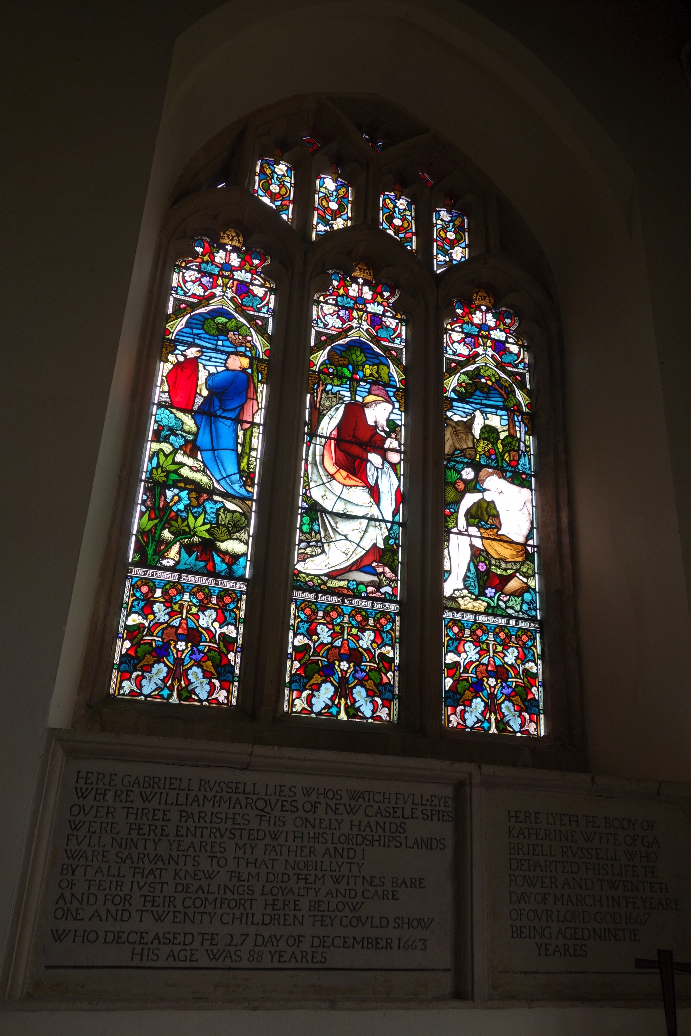
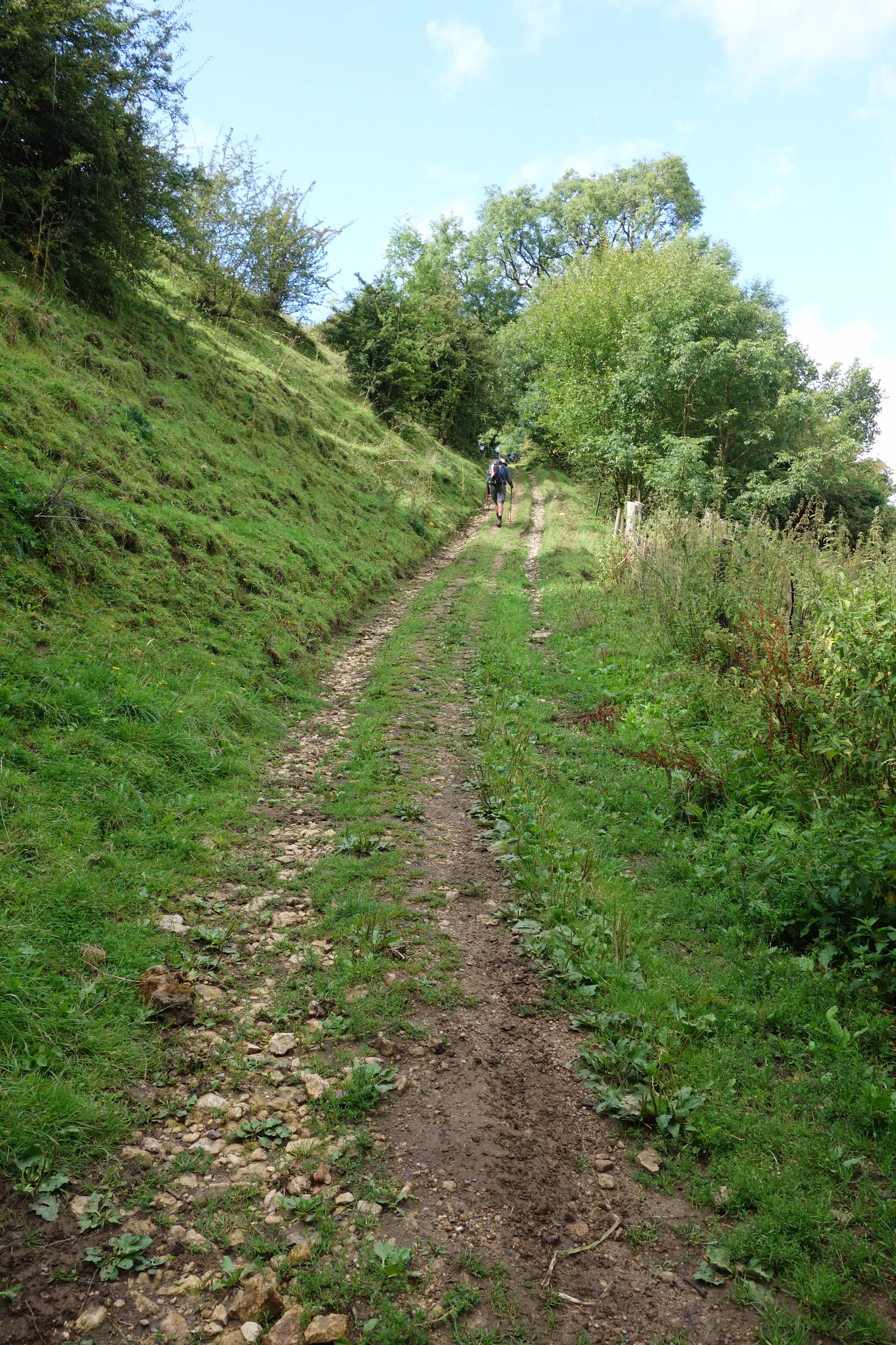
What McCloy’s book, The Land’s End to John O’Groats Walk, makes very clear, though, is that with the proliferation of National Trails in the U.K. it’s gotten a lot easier to walk from one end of the country to the other while avoiding roads–and remember, because highways in Europe generally don’t have shoulders, it’s dangerous to walk along them. McCloy maps out a route that, in addition to using country roads and footpaths, would take walkers along the Cotswold Way, the Staffordshire Way, and the Pennine Way to Scotland, and then along the St. Cuthbert’s Way, the Southern Upland Way, and the West Highland Way through Scotland to Inverness. The only time one would have to walk along a highway would be north from Inverness, but McCloy suggests that isn’t a problem because there is little traffic in the highlands. Unfortunately, McCloy’s maps aren’t detailed, and one would have to spend a small fortune on Ordnance Survey maps of the U.K. to work out a clear route, since there would be a lot of traveling between those waymarked National Trails. I suppose planning the route would be half the fun, if you consider walking 1,000 miles fun. I’d like to think I would consider it, if not fun, then a worthwhile accomplishment. After all, I enjoyed walking 500 miles in Spain, and my only complaint about the 100-mile Cotswold Way is that it was too short.

Still, I’m not sure that the Land’s End to John O’Groats walk is in my future, for many of the same reasons that I can’t imagine walking the Appalachian Trail in one go. Would I really want to be away from home and on the road for two or three months? Could I physically manage to cover that kind of distance? I mean, I was pretty exhausted by the time I got to Santiago de Compostela, and the LEJOG route (that’s McCloy’s short form) is twice as long. Maybe it would be more reasonable to focus on individual National Trails–to spend a couple of weeks walking the Pennine Way, for example–instead of attempting something as challenging as an End-to-End walk. Still, Hillaby’s book leaves me wondering what it might be like. It’s worth thinking about. Maybe I’ll add the Land’s End to John O’Groats walk to my list of trips I’d like to take before I’m too old to take them. But I can’t see myself ordering the maps and planning the route just yet.

Looking Back on the Cotswold Way

DSC00634

I’ve already been asked if I’d walk the Cotswold Way again. The answer is yes, but also no. Yes, I would love to go on another walking trip–I’d leave tomorrow if I could. But I’m not sure I’d walk in the Cotswolds again. It was beautiful but there are many other places I’d like to walk before I return there. That doesn’t mean that I didn’t enjoy it, though, or that I wouldn’t recommend it to other people.

DSC00889

The trail is well-maintained and (for the most part) the waymarking is very clear. We met a couple from Cheltenham, a city in the Cotswolds, who told us that they started taking day walks along the Way because of their experience walking regular footpaths. Often, they said, they’d end up stymied by locked gates or paths that had been ploughed over by farmers. They found themselves having to climb through hedges–and since the hedges contain blackberries and stinging nettles, that would be (to say the least) an unpleasant experience–or wading through the mud of a recently ploughed field. One day they ran across a Cotswold Way path. They were surprised by its good condition and decided they’d limit their country walks to the Way. My limited experience supports what they told us. When I walked from Blenheim Palace to Oxford, the stiles and gates were in poor condition compared to what we found on the Cotswold Way. The volunteer trail wardens do an incredible job of making sure that the trail is well maintained. In fact, one of the ways you know that you’ve gotten off the path is the sudden drop in the quality of things like gates and stiles, which are suddenly old and half-rotten or kept closed by loops of twine instead of latches. Obviously local councils have more pressing priorities than maintaining footpaths. What’s even more amazing is the fact that anything needed to maintain the Way, from gates to gravel, is provided through charitable fundraising.

DSC00871

That doesn’t mean that the Way is groomed, though. It turns to slippery mud when it’s raining and sometimes, where gravel has been added to it (to stop erosion, I think) the stones are (as they were in Spain) large and hard on the feet. Also, because so few people walk on it (compared to the Camino Francés) it can be narrow and edged by tall grass. And while walking across grass pastures is easy on your feet, it also creates more friction and slows you down a little. We met a couple from Virginia who were unhappy with the condition of the trail, but I think their expectations were out of line. They must’ve been in their seventies and I think they were blaming the trail for the fact that they found it difficult. Because it is difficult–there’s no way around it. The hills can be steep and you have to watch where you put your feet sometimes. We were glad to have walking poles on the more challenging sections. But I don’t think that’s unique to the Cotswold Way. Parts of the Camino Francés are hard, too, and from what I’ve read other trails are even tougher.

DSC00884

The only drawbacks to the Cotswold Way (aside from the expense of staying in B&Bs compared to albergues or hostels) are its length–you’re just getting into the rhythm of the walk, just starting to get fit enough to tackle the hills, when it’s over–and the fact that you don’t meet many other people who are walking from one end to the other. But if you have a week or ten days and the inclination to go for a walk through some achingly pretty countryside, the Cotswold Way is worth considering.


Walking the Cotswolds, Days Seven and Eight

There was no wifi yesterday and I was too tired after our longest walk to do much more than walk to the pub for dinner at the famous Beaufort Arms. We were told, “People drive there all the way from Bristol!” I can believe it.

image

image

It was hot and very humid for most of the day yesterday and then for some reason the humidity eased late in the afternoon. We ate a picnic lunch on a bench across the road from a church where a soldier and his gal were getting married. It seemed as if every young person in the village was there in their finest clothes. We shared a bottle of strong ale which didn’t make it any easier to climb the afternoon’s hills.

image

image

The hills are, as my friend Geoff suggested, getting easier as we get fitter, but also, let’s not forget that the Cotswolds get flatter as we get closer to Bath. Still, it’s an accomplishment to reach the top of the biggest ones even if I’m sweaty and gasping. The big breakfasts and pub lunches don’t help. Clearly I’m going to have to spend the winter on the stairmaster before next summer’s walk, whatever that’s going to be.

image

image

Despite the talk of bulls, angry cows, wild boars, adders, etc., the biggest hazards we’ve encountered have been stinging nettles, which are everywhere, and low doorways and low-hanging branches. A phrenologist would have me committed because of all the lumps on my head.

image

image

Oh, and English drivers. We crossed the A46 several times today and each crossing was terrifying. Outside the village of Pennsylvania, where drivers are supposed to slow to 40 miles per hour, they were travelling closer to 75. I would hate to live there, with cars going that speed past my front door. This country could do with a little photo radar. There are CCTV cameras everywhere already, so why not use a few to make the roads safer?

image

image

We also crossed the M4 today, and the endless stream of vehicles speeding towards Bristol and then Wales made me think about the difference between travelling that way and walking. Driving down an expressway is faster but it’s also a kind of suspended animation, while when we walk we’re very much alive to the sounds and sights and smells of the world around us. I thought about this walking along the edge of a field of harvested sunflowers. The grass at the edge of the field had been cut, too, and it smelled like fresh hay. The wind was singing in my ears and in the next field, a pasture, sheep were bleating. It was wonderful. From here, we could be in Bath in 15 minutes but it’s the experience of walking that’s the point, the journey and not the destination. Or something.

image

image

This morning it rained on and off, and then late this afternoon the skies opened up and the rain simply poured down. Once again my boots filled with water because I forgot my gaiters back home. This never happened in Spain and I didn’t have gaiters there either. What a conundrum. I was able to ponder it as we splashed towards Cold Ashton.

image

image

Our B&B is the first we’ve encountered that’s set up for walkers, with space to dry wet clothes and a machine for drying sodden boots. The owners walked the Cotswold Way before they opened up last year and it shows. We’re in the middle of nowhere so dinner is provided, but we do the cooking ourselves. Interesting concept. It’s all very nice and there’s beer, too, which is exactly what tired and thirsty walkers need. After all, we walked about as far as we did yesterday and deserve a reward after our exertions.

image

image

Tomorrow we will be in Bath and our walk will end. I wish we could keep going–I’m just getting into it.

Walking the Cotswolds, Day Six

According to our guidebook, Dursley has been destroyed by urban planners but I saw little evidence of it. It’s just a regular town–not Cotswolds pretty but okay in its way. I’m not sure why it has a bad reputation. We did get lost but that’s not the town’s fault and everyone was quite nice to us. We had a tremendous lunch at the award-winning Old Spot Inn–supposedly the best pub on the Way–and unfortunately it doesn’t serve supper.

image

We left Middleyard early after another huge breakfast (between full English breakfasts and real ale I’ll have to buy new trousers when I get home) and after a long climb through a forest we arrived at Coaley Peak. There was an amazing view of the Severn River valley, all the way to the Channel, including (according to the sign there) Tintern Abbey. Wordsworth was a indefatigable walker, apparently, unlike me–I get fatigued, but not today, not on this short, 13 kilometre stretch, the shortest of our tour. Then a coursing hawk reminded me of another poet and his sparrowhawk: “I caught this morning morning’s minion, king-/ dom of daylight’s dauphin, dapple-dawn-drawn Falcon” and so forth. “The Windhover” has long been one of my favourite poems. I shouldn’t “and so forth” it but typing on the iPad is tiresome and you can always look up the rest. Then it was back down into the valley. Two miles from Dursley, we turned for another stiff climb up to the top of Cam Long Down, and then we had another descent into the town.

image

We passed another long barrow at Nympsfield. this one was missing its roof so we were able to see how the burial chambers were arranged. We missed another, the strangely named Hetty Pegler’s Tump, because the only path to it leads I. From the road, not the footpath, and we didn’t understand that until it was too late. Christine was disappointed. You can crawl right into the caverns there and I think she wanted to do that. Not me. I’m not going into someone else’s tomb even if their bones were removed by Victorian anthropologists. No thanks. anyway, lesson learned–read the guidebook more carefully.

image

After lunch, we wandered around Dursley for a while. Christine had coffee and went window-shopping and I looked for reflector tape to put on our raincoats (a motorist stopped a few days ago and told me we were next to invisible on the road). the bicycle shop didn’t have any. they suggested I try the motorcycle shop, which was closed. so no more walking along the road in the rain unless we absolutely can’t help it. Maybe I’ll use my headlamp–that’s why I brought it.

image

Our B&B is up on another hill south of Dursley. Our directions were rather poor and we had trouble finding it, but it’s very nice. It’s in an Edwardian estate. There are dogs and horses and chickens and our host served us elderflower water and cake. Then we had a chat with another pair of walkers, an English couple who are walking the Cotswold Way in stages, as day trips. it was the first time we’ve had an extended conversation with other walkers and it reminded me a little of the way peregrines talk to each other on the Camino. Neither of us has much of an appetite after our huge lunch, so we’re planning to have a little picnic instead of heading back into town for supper. Then it’ll be an early night, since tomorrow is our longest day of walking on this trip.

image

Walking the Cotswolds, Day Five

Our hosts last night had a book on the shelves in their hallway: 50 Crap Towns in the UK. Painswick, the village where we were staying, definitely wasn’t one of them. It was yet another picture-postcard Cotswolds village. Middleyard, where we are tonight, is a little more down-to-earth. It’s a suburb of Stroud. The pub down the road where we ate dinner is more like the pubs I remember from previous visits to Britain: a little shabby but good enough.

We had two odd animal encounters today. At Haresfield Beacon, a lookout point with 360-degree views of the valley below, a herd of cows was occupying the footpath. They were reluctant to share and snorted ominously as we approached. I was mindful of the story about the woman in Lincolnshire who was trampled to death by an angry cow while walking and avoided making eye contact while murmuring “that’s a good cow” in what I hoped was a reassuring voice. We were between the cows and the escarpment, which didn’t make me feel any better. But they were only bluffing.

image

Later, as we entered King’s Stanley, a horse became convinced that Christine was harbouring something edible and followed her, mumbling her pack and slobbering on her water bottle.

image

Our route today took us along footpaths and bridleways and restricted byways; through ginnels, snickets, closes and alleys; along roads and highways and streets; through woods and forests; on bridges across streams, railway tracks, a river; over pastures, through a wheat field and a hop yard.

 image image image

image image image image

image

image

 image image image

image image

image

Unlike the Camino Francés, much of this trail is on private land, something that continues to amaze me. Imagine Canadian farmers putting up with strangers wandering across their pastures and through their farmyards! I can’t.

Tomorrow is our shortest walk on this trip. Our destination, the village of Dursley, is the inspiration for the name of Harry Potter’s adoptive family. We’ll see if it’s as cruelly repressive and miserable.

Walking the Cotswolds, Day Four

It rained on and off all day. Whenever I thought it might stop, it would start again. I stopped to take a pee after we entered a National Trust forest and was surprised by the sudden appearance of a woman walking her dog. It turned out that the paths through these forests are popular routes for dog walkers and most of the people we saw were accompanied by their canine companions.

image

We walked through the site of a Stone Age fort and then got lost. We’d taken the wrong path and were headed in the opposite direction. Unfortunately, the right direction meant crossing a very busy roundabout. I saw a gap in the traffic and ran for it. Christine was trapped in the centre of the roundabout for ten minutes until a kind driver stopped for her. Then we were into a beech forest. Christine loves the mood the old beech trees create and these forests have become her favourite places to walk.

image

Then it was off the path and up a hill to a village where we’d been told we’d find a pub for lunch. It was one of the big pubs run by Greene King, a brewery. It’s become very difficult for ordinary pubs to survive on selling beer and bar snacks (stricter enforcement of drunk-driving laws and a ban on smoking inside bars and restaurants have encouraged many of their customers to stay home with cans of cheap lager) and most of the pubs we’ve seen have been like this one, more like fancy restaurants or hotels. Food’s good, though.

image

In the afternoon we walked through a thick forest which kept us dry. We could hear the rain but little penetrated the dense canopy of leaves above us, so we were able to put our rain gear away. we made a long, muddy descent on some kind of forest access road, past a fenced clearing where the trees had been recently coppiced–cut close to the ground so that they begin to grow new shoots. The new growth is a favourite food of deer, who have to be kept away or they will eat all of it and kill the trees. Eventually we began a long, muddy climb, proving that what goes down must also come up.

image

There were more hills to come and we were very tired when we found another pub. This one had an espresso machine and we drank coffee and ate cookies in our muddy clothes and boots. Then we pushed on, across a very tricky golf course where you couldn’t see any of the greens from the tee, and eventually into the village of Painswick. We ate a delicious dinner at a restaurant populated by moneyed Londoners and then went back to our B&B where we slept heavily. Our walk was only 20 kilometres but with the hills it seemed much longer. Our speed was a frankly embarrassing three kilometres per hour. Even allowing for frequent map checks and stops to admire the view, that’s a pretty poor performance. However, like Geoff says, this is the adjustment period, where we get used to climbing hills, and in time they will get easier.

image

Walking the Cotswolds, Day Three

I was still tired from yesterday’s hills when we left this morning. Our first challenge was a steep climb to the top of Cleeve Hill common, where we were rewarded with spectacular views of Cheltenham and, in the distance, Gloucester, the Black Mountains and the Malvern Hills. There is a golf course on the common with sheep grazing on the greens. Please don’t hit any livestock with your ball, or any walkers trying to get past the 14th hole.

image

image

Then it was a long trek across Cleeve Hill, through a nature reserve, into a valley and then up another hill on the other side. Late in the afternoon we reached Leckhampton Hill, the point where the people from our B&B were to pick us up and drive us to their farm. It was only 15 kilometres, according to the guidebook, but with the hills it felt like much longer.

image

image

image

Our route took us around the city of Cheltenham, birthplace of Gustav Holst and Brian Jones, which disappointed Christine. However, we had many opportunities to see it from a distance as we walked. We saw many people out for a stroll in the late afternoon, but few who looked like they were attempting the Cotswold Way, which rather surprises me. We did see a couple with backpacks at Belas Knap, the Neolithic burial site, yesterday and another couple this morning on Cleeve Hill common, but given the density of inns and B&Bs around here I had expected more walkers. I suppose most tourists are sane and drive from place to place.

image

image image

Now we’re waiting for a lift to the local pub for dinner. Tomorrow we return to Leckhampton Hill and walk to a little village called Painswick. There’s a pub in Birdlip, the halfway point, so we won’t have to picnic in the rain, the way we did today. Still, the rain does make the flowers grow. Speaking of which, we passed through endangered grasslands today, home to rare species of wildflowers and butterflies. According to the guidebook, most of these grasslands have been ploughed under in the last 70 years. All of that would’ve been on private land–a foretaste of what is to happen after our provincial government sells off the community pastures back home.

image

Walking the Cotswolds, Day Two

image

Framed gossip columns from News of the World in the bed and breakfast’s WC. What could they mean? Is the proprietor one of the women mentioned? The mystery remains unsolved.

If I were a superhero, the full English breakfast would be my kryptonite.

A sunny day turns rainy mid-morning and then the sun returns. Views, vistas, at the top of every hill. Huffing and puffing on the ascent, knees and calves aching under the strain on the descent. After each village, another series of hills and then the next village.

image

image

We eat breakfast with a Dutch couple. They turn out to be surprisingly fast walkers and we catch glimpses of them far ahead of us occasionally before they leave us behind completely.

image

Expensive hobbies in the Cotswolds: horses and vintage cars, especially MGAs. The cars too fast for photographs, their drivers wearing flat caps and scarves, clichés brought to life. The horses more cooperative. We give one an apple Christine took from the breakfast buffet our first day in Oxford. He immediately ignores us and concentrates on eating. Another comes to the fence to be scratched and petted. She is given handfuls of grass and tries to eat my camera case and the strap on Christine’s backpack.

image

image

Walking through pastures, through wheat fields, corn fields. This would not be allowed at home but here the right of way takes precedence over seeding another row.

image

image

image

Lunch.

image

Food was also served.

Warnings on gates: bull in field. No bull to be found, just cows and calves, although the first time we see a sign we walk as fast as possible, without running, towards the opposite gate. Farmers must leave the signs out to keep walkers from getting too comfortable.

 image

image

Walking through forests, through beech hangars. Dappled shade a relief from the hot sun. Blackberries, raspberries, wildflowers. Poppies along fences.

image image

image image

Fields of wheat to the horizon, a reminder of home.

image

Arrive at the hotel sunburned and footsore. Pints of beer, big dinners. A cover band playing, keeping weary ramblers awake. Back to the bar for another drink?